Continuing our Journey on U.S. 7, which gains added beauty ,as it goes north, we enter the town of Kent. As in the other northwestern towns, shares were sold at auction, entitling the purchasers to take up land under certain conditions. The sale for Kent took place at Windham in March, 1738, the bids to start at Ł50 per share. The majority of the purchasers were from Colchester, with others from Norwalk and Fairfield. Actual settlement began the same year, and the town was incorporated in 1739. The name was taken from the English county of Kent.
Kent may be described as a mountain country, some of it still farmed, cut by a deep river valley with broad bottom lands, adapted to corn and tobacco. There was an important iron industry, and the present town has attracted schools and summer homes, with an artists' colony. Kent is one of the best centers for tramping in Connecticut. It contains two State Parks: Macedonia Brook and Kent Falls.
At the south end of the town, the Housatonic has cut a gorge through the limestone, with tine potholes and characteristic limestone flora. This is a good place to study the relations of the limestone and schist. For a view of the rapids, especially fine in high water, walk west 100 yards, just beforre crossing the power canal. Bulls Bridge, above this point, is one of the few covered bridges surviving in Connecticut. The unimproved Rt. 130 leads east to South Kent, passing on the right Pickett Rock, with a fine west view, and on the left South Kent School, established in 1923 as an offshoot of Kent School. About a mile east of South Kent (1st left turn) is the location of the Kent Iron MInes, an important source of ore. Exploitation began soon after the settlement. Of the early furnaces, one was located on Forge Brook, at the entrance to Macedonia Park, where the oak timbers can still be seen under the water. There was a forge at East Kent, ore being transported up the mountain on horseback. By 1845 there were three blast furnaces in operation, employing 280 hands and turning out 3,000 tons a year. The picturesque ruin of one of the furnaces stands just north of Kent village, across the R. R. opposite Gilbert's store.
In Kent Village there is a Community House, an annual art exhibit, and a World War Memorial Library, in Colonial style, designed by Heathcote M. Woolsey. Crossing the river to the west on R. 341, we come to Kent School with its attractive buildings, an Episcopal preparatory school for boys on the self-help system, established in 1906 by Father F. H. . Sill. Going 1 1/2 miles farther a road turns north to Macedonia Brook State Park, the gift of the White Memorial Foundation in 1918, a tract of 1830 acres along the beautiful Nodine Hollow Brook and on the slopes of the adjacent hills. The park has facilities for picnicking and camping.
On the west bank of the Housatonic, just behind Kent School. a country road leads in 11/2' miles to the Schaghticoke Indian Reservation. There was at one time a large Indian settlement, which contributed 100 scouts to the Revolutionary armies. The Moravians maintained a mission. The Reservation is now reduced to about a hundred acres, where a dozen half-breed Indians still reside as wards of the State.
East of the village, R. 341 to Warren gives a delightful drive over the hills. After passing a good lookout hill about 1 mile to the south, we reach in 3/4 miles the two Spectacle Ponds. Above North Spectacle Pond is a representative spruce-tamarack bog. North of this is an outlying portion of Mohawk State Forest; a hill about a mile above the Pond gives a good view to the southwest.
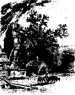
The original Kent settlement, a mile north of the village, is known as Flanders, and it is here that we find our exhibit of old houses. Several of them have entrance porches of a charming local variety: slender columns supporting an open gable, usually with a molded cornice. The best is the *Mills House (Mary Bacon House) 1 mile on U. S. 7, and 1/2 mile east. The older portion, now the kitchen elI, probably dates from the middle of the 18th century, and decorations were added to match the later house. The main house, early 19th century, designed and largely built by John Mills, great-grandfather of the present owner, is one of the finest examples of Colonial decoration in the State. A cornice molding of unusual beauty follows the entire line of the roof, and there is similar treatment above all the windows. The main entrance porch shows the local type at its best; the east porch in the same style is a modern addition.
On U. 5. 7, opposite Flanders Armss, with one of the graceful porches, stands a house, less pretentious than the Bacon house but of fine proportions and about the same period, now known as Seven Hearths. Above one of the fireplaces is a panel of great beauty, made of a single piece of pine 4l 1/2 inches wide. The planks around the lower part of the walls are 3 feet wide and 2 1/2 inches thick. The next house to the north, still older, with long sloping roof, was once the Congregational parsonage; the earlier Kent church stood at the fork of the road.
North of Flanders, the highway is particularly fine, with the gray cliff of St. John Ledges across the river. About a mile below the Cornwall line we come to Kent Falls State Park, another gift of the White Memorial Foundation, a popular picnic ground with ample parking space. The brook drops about 200 feet in a quarter of a mile, over ledges of white marble with many potholes, amid a setting of hemlock and hardwood. The lovely upper cascade, which must be reached on foot, has a fall of about 80 feet. There are several acres of old hemlock in the Park, with characteristic ravine vegetation.
The long Appalachian Trail for trampers, running from Georgia to Maine, enters the town from New York State on the eastern slope of Schaghticoke Mt., with extensive views of the Housatonic valley. It then crosses the beautiful Thayer Brook ravine, climbs over Pine Ledge with its moss-covered boulders, and descends by the Grand Staircase to Kent School. North from R. 341, the trail climbs Kent Rock, with its memorial cross as well as school class numerals, which commands a fine view of the valley. From Macedonia Brook, we climb west to Cobble Mt., with a very extensive view, and cross to Pine Mt., where we look down the Macedonia valley, framed by wooded hills. The trail then leads east to the viewpoint at Caleb's Peak, and descends to the Housatonic over the spectacular St. John Ledges. Crossing the river at North Kent, we follow the river bank to Kent Falls, ascend the brook and head east for Mohawk Mt. This trail, which gives some of the linest tramping in the State, is marked with the standard light blue paint. The best approach is to go west from Kent 3/4" mile on R. 341, where the trail may be taken either north or south. A descriptive leaflet and map should be secured from the Conn. Forest and Park Assn.