
The town of Salisbury, in the northwest corner of the State, originally known as Weatogue, was first settled about 1720 by Dutch families from New York. Other grants were made to citizens of distinction by the General Assembly, as was its custom. The remaining lands were sold at auction in 1738. A town was incorporated in 1741, taking its name from Salisbury in the English Wiltshire. The town was closely connected with the settlement of Vermont, to which it contributed Ethan and Ira Allen, and three early governors.
Salisbury is surrounded by mountains and contains the highest elevation in the State. There are beautiful lakes in the center and north. Abundant ore of high quality brought an important iron industry, and there are large deposits of lime. The town has attracted schools, artists and summer homes. There are four centers: Lime Rock, Lakeville, Salisbury, and Taconic.
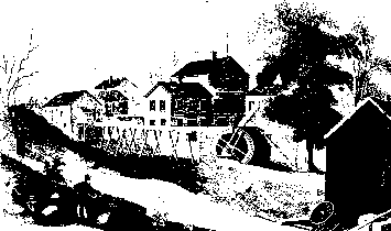
U. 5. 7 crosses the southeast corner of the town. Turning west on R. 112, with extensive limestone quarries 3/4 mile to the northeast, we pass through Lime Rock, formerly known as the Hollow, the seat of the earliest iron forge in the town, built by Thomas Lamb between 1732 and 1734. A large iron industry was carried on here by Barnum Richardson during the 19th century. The village was later discovered by artists, who converted deserted mill buildings and workmen's houses into studios and modern homes. Annual exhibitions are held in the converted postoffice. Besides individual crafts, there is an establishment for handmade rag paper, the only one in America. On Salmon Fell Kill, at the north of the village, below an old mill dam, is an attractive waterfall.
West of Lime Rock, we join R. 41 coming north from Sharon and pass the buildings of Hotchkiss School, above Lake Wononscopomuc, an endowed preparatory school, established in 1892. The village of Lakeville, formerly Furnace Village, was the seat of the most important early blast furnace in Connecticut. The site, at the outlet of the Lake near the Bank, has been marked. A small forge was erected here in 1748. In 1768 the property was purchased and remodeled into a blast furnace by John Haseltine, Ethan Allen and Samuel Forbes, in order to produce cast rather than wrought iron. Before the Revolution, it had been acquired by Richard Smith of Boston, whom we shall meet again in Colebook. When the war broke out, Congress took over the plant and it became one of the principal arsenals for the Continental armies. About 60 workmen were employed. Cannon up to 32-pounders were cast here, as well as cannon-balls and shells.

In Lakeville Village, to our right as we cross the R.R., is the Sterling House (R. I99, south side) built by Gen. Elisha Sterling about 1795. On the north side of the main street, the Farnham Tavern is of about the same date, and west of this is the John M. Holley House, built about 1808.
Route 199 climbs westward above the Lake to the principal sources of iron ore, classed as limonite, a hydrated iron oxide. The old mines are now largely filled with water. Ore Hill, to the north of the highway, was opened about 1732 and operated until 1921. The later Chatfield Mine lies to the south, on the unimproved portion of R. 112. North of R. 199 are two fine outlooks: Beecher Hill, reached by a town road 1 mile west of Lakeville: and Bird Peak, close to the New York line, by the same road and a half mile climb to the north. Northeast of Lakeville by R. 199, the Davis Ore Bed lies about 1 mile from the village and 1/2 mile west of the highway.
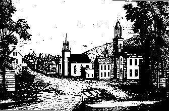
On the elm-shaded street of Salisbury VilIage, we have the attractive Congregational Church built in 1798, with a Palladian window above the pedimented doorway, and another in the tower; there are quoins and heavy dentils. The Town Hall with its white columns was remodeled from the earlier church building of 1749. The granite Scoville Library has a fireplace mantel with a piece of bas-relief from the cathedral in Salisbury, England. The old Bushnell Tavern (Warner House) opposite the Library, dates from about 1800. The Stiles House, farther south on the same side of the street, built in 1772, has a slight overhang and is practically unchanged. Salisbury has an annual Ski Tournament, the sport having been introduced by some Norwegian workmen.
From the south end of Salisbury Village. the Mt. Riga Rd. runs northwest through a beautiful ravine, with Lion's Head on our right. Just south of Mt. Riga is another important furnace site, the ore having been hauled up the hill to take advantage of the water power and charcoal. According to tradition, the anchors of the frigate "Constitution" were forged here. The traveler who does not mind rough going should continue north to Massachusetts, with mountains to the right and lakes to the left. We pass Bingham Pond, the highest pond in the State, with a quaking bog, characteristic bog plants, and fine specimens of black spruce, tamarack, cassandra and mountain ash.
R. 41 runs north from Salisbury to Massachusetts, under the Mt. Riga range, passing on the left in about 2 1/2 miles the Camp-Ball House, built about 1745. R. 199 goes northeast to Canaan. We pass on the right in a sightly location the Salisbury School, a preparatory school for boys, established in 19O1. A little beyond this, the highway gives a fine view over Twin Lakes. Many summer homes have been built on the shores, and for the botanist the lakes have an unusually fine development of aquatic plants. The Limestone Caves are reached by taking the road between the lakes, 1 mile north from R. 199, and walking west on an old road about 1/4 mile. The acid of the rain water, draining through the porous rock, has eaten holes, as in the Kentucky caves. By crawling on one's stomach, one can penetrate several chambers of considerable size, with stalactites hanging from the roof.
The Appalachian Trail with its blue marking crosses from Canaan at Falls Village. Passing through the earlier industrial settlement of Amesville, we climb Prospect Hill, passing an attractive waterfall; there is a side trail east to the summit, which commands a fine northern view. Here and along the main trail we see for many miles up the Housatonic Valley, with the Taconic range on the west and the Berkshires on the east. The fine Colonial house a little north of the trail, with a superb outlook, was built about 1765 by Thomas Chittenden, who became the first governor of Vermont. Descending Barrack Matiff Hill through one of the finest hemlock groves in the State, and crossing the valley north of Salisbury, the Trail climbs *Lion's Head, with the same remarkable northern view. A side trail leads to Bald Peak (Mt. Riga) with a complete horizon. We follow old coal roads north to Bear AIt., 2355 feet, the highest point in Connecticut, and descend to *Sage's Ravine on the Massachusetts line, a wild wooded gorge with a succession of waterfalls. There is luxuriant moss and other characteristic ravine vegetation. with essentially primitive hemlock and northern hardwoods. The Ravine is privately owned and must be approached from above, but a convenient feeder trail climbs west from R. 41 to the Appalachian Trail. The Trail continues north to Mt. Everett, and eventually Mt. Katahdin in Maine.