Other observations, thoughts and questions: (mine and others)
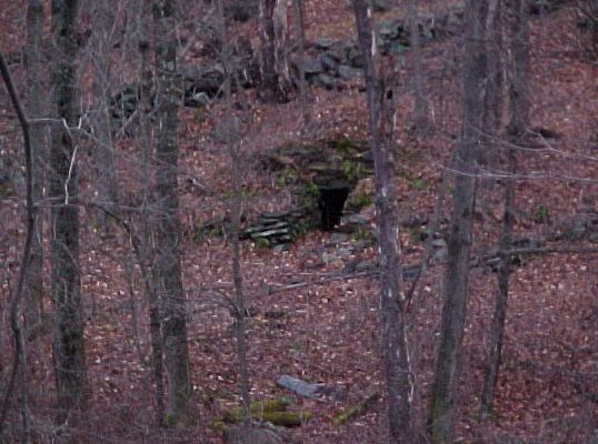
-Some of the chambers have habitation evidence nearby, some do not
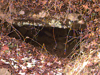
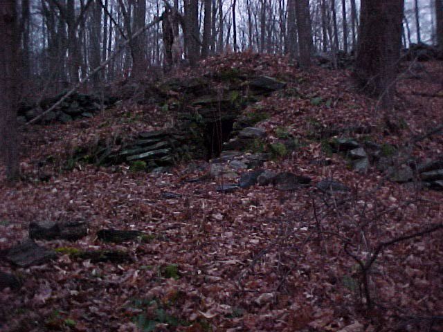
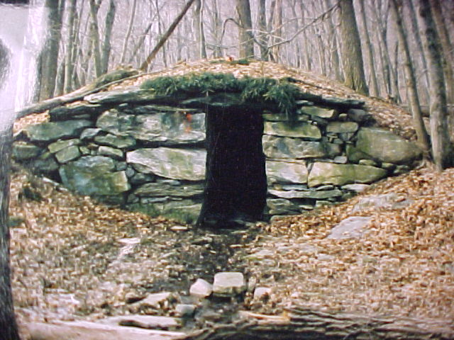
-I don't believe these were to be lived in, there are no fireplaces, etc.
-Could they just be food storage areas? They would be bear and wolf proof with a heavy enough door.
-Some say Irish potato farmers built them, but in the valleys I viewed the chambers, I challenge anyone to grow potatoes, rocks would be the best crop
-Why did they not build log roofs?
-If, as some allege, the chambers are solar aligned for solstice and equinox, why aren't all of them aligned?
-If they are ceremonial centers, why did they build so many of them in one area?
-Could they be shelter for area shepherds? The land lends itself to raising sheep. Some of the stone walls in the area seem like penned areas.
-Some of the chambers have mortared areas, but this could have been added at a much later time
-One had a metal ring attached to the wall, to tie up an animal?
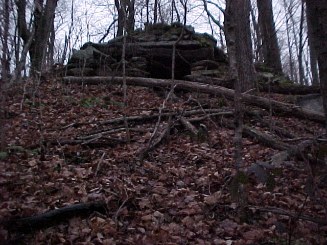
-But, some of the chambers are on steep hillsides, would you lead a cow up the hillside for shelter?
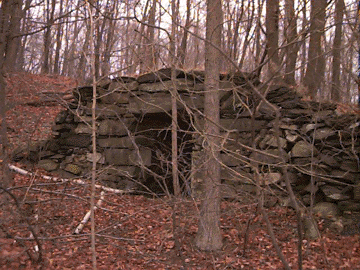
-The Putnam Valley chambers I viewed were built out of the very abundant area stone
-And the chambers were usually built on a hillside where the large lintel stones could be dragged downhill and into place after the side walls were constructed
-I have seen similar construction in other Revoltionary War reconstructions
-The lintel stone roofs - but are there any other ways to build a roof? Yes, archs, corbelling, but this is the easiest, fastest, most efficient
-How about the drill marks or quarrying evidence?


p. 577 - "Fishkill Village -...Early in the Revolutionary War the Colonials fortified Wiccopee Pass, to the south, to block a land advance by the British. Barracks and storehouses were built here and the few houses were crowded with refugees from New York City."
p. 579 -"The road passes through the southern defile of Wiccopee Pass, the strategic point vigilantly guarded by three Colonial batteries from 1776 to 1783 to prevent the British from seizing the near-by military stores. The lines of the earthworks, several hundred feet apart in the form of a triangle, are still traceable on the hilltops. To the southwest is a lookout point used in relaying messages from Washington's headquarters in Newburgh. On the heights overlooking the pass Harvey Birch had his mysterious interview with Washington after his 'escape' from Fishkill, as narrated in Cooper's The Spy.
For 10 miles US9 follows creek valleys between high hills. Here the ragged troops of Washington and Putnam dug in after their Long Island defeat. Almost every other mountain has a line of trenches, now overgrown with brush.
p. 396.....the site of Continental Village, a supply base that had barracks for 1,500 men. The barracks were burned by the British in 1777 and the site was not reoccupied until 1781.
The interior of Putnam County, between the Albany Post Road on the west and the Harlem Valley on the east is a region of rough topography, with summits from 1000 to 1400 feet, broken in the southeast portion by several reservoir lakes, and more northerly, by a number of small natural lakes or old millponds. It was formerly much more thickly populated than now, and the abandoned farms, as in the Highlands generally, are growing up in second growth forest. Many of the roads shown on the West Point and Carmel sheet of the United States Geological Survey are now little used, and scarcely passable for automobiles, but make pleasant hiking routes....
The southern part of the county is rich in Revolutionary associations, and was occupied by Continental outposts, camps and forage depots. Some of the names, like Fort Defiance Hill and Fort Hill, east of the Post Road, bear evidence in their names of such military occupation, though few traces are now left of the works. Continental Village, now marked by a monument on the road fork, seven miles northeast of Annsville, was the site of a provision depot burned by the British in a raid up the Hudson in October, 1777. There are many old iron mines in the region, some worked from before the Revolution, others actively up to sixty years ago, but now all abandoned.
In the month of March, 1777, Colonel Bird, with a detachment of the British army, went up the Hudson, and at Peekskill, in the County of Westchester, destroyed all the rebel magazines, barracks, and storehouses erected at that place, with an amazing quantity of provisions, military stores, clothing and accoutrements, of almost every kind; demolished their fortifications, and returned to New York without the loss of a man."
North of the Putnam Valley chambers that I know about is Fahnestock State Park, where I am told are numerous chambers.
Fahnestock State Park area- "The Old West Point Road, which ran from the Old Albany Post Road to the Hudson River, saw considerable activity during the Revolution, while the Cold Spring or Eastern Turnpike shown on old maps followed the route now taken by Route 301."